Innovative
sitour Italia combines decades of experience with the constant search for innovative solutions, developing state-of-the-art technologies and media strategies for mountain regions, always geared to market needs.
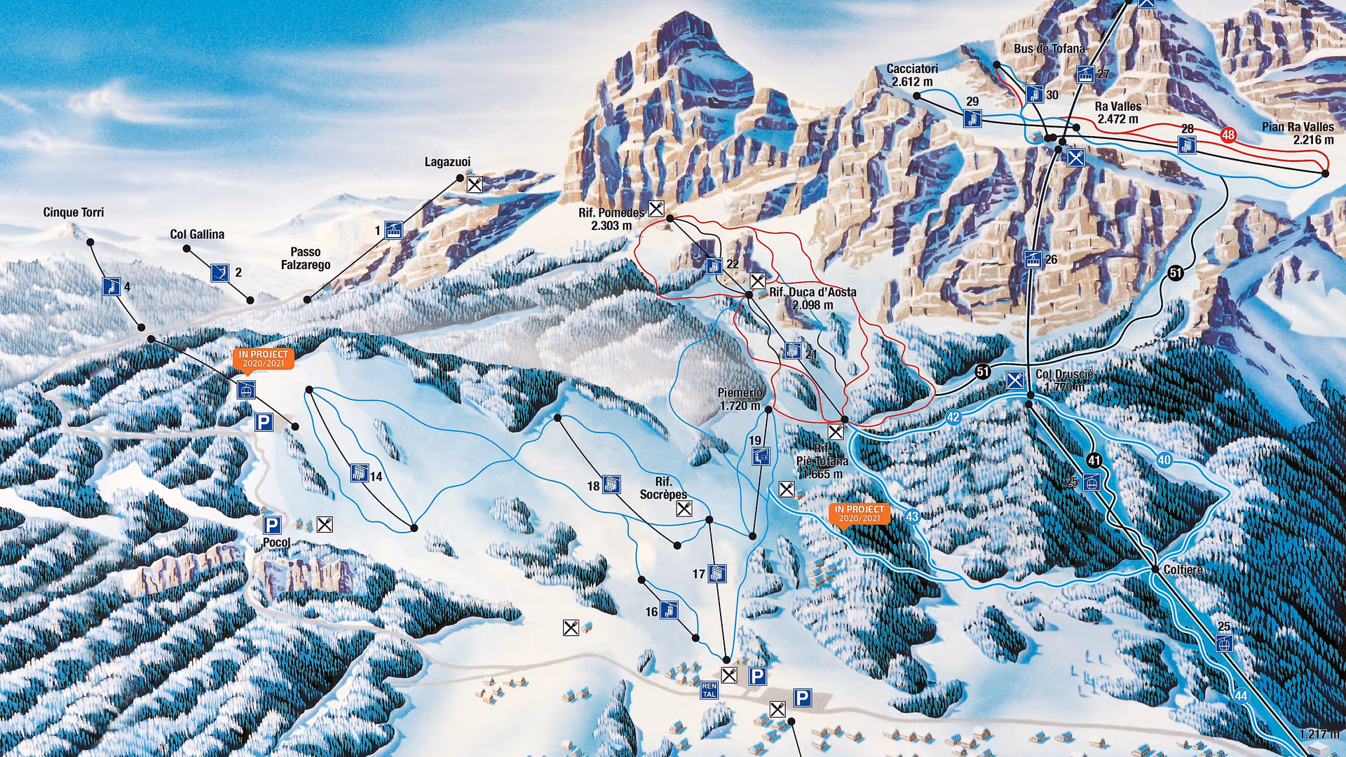
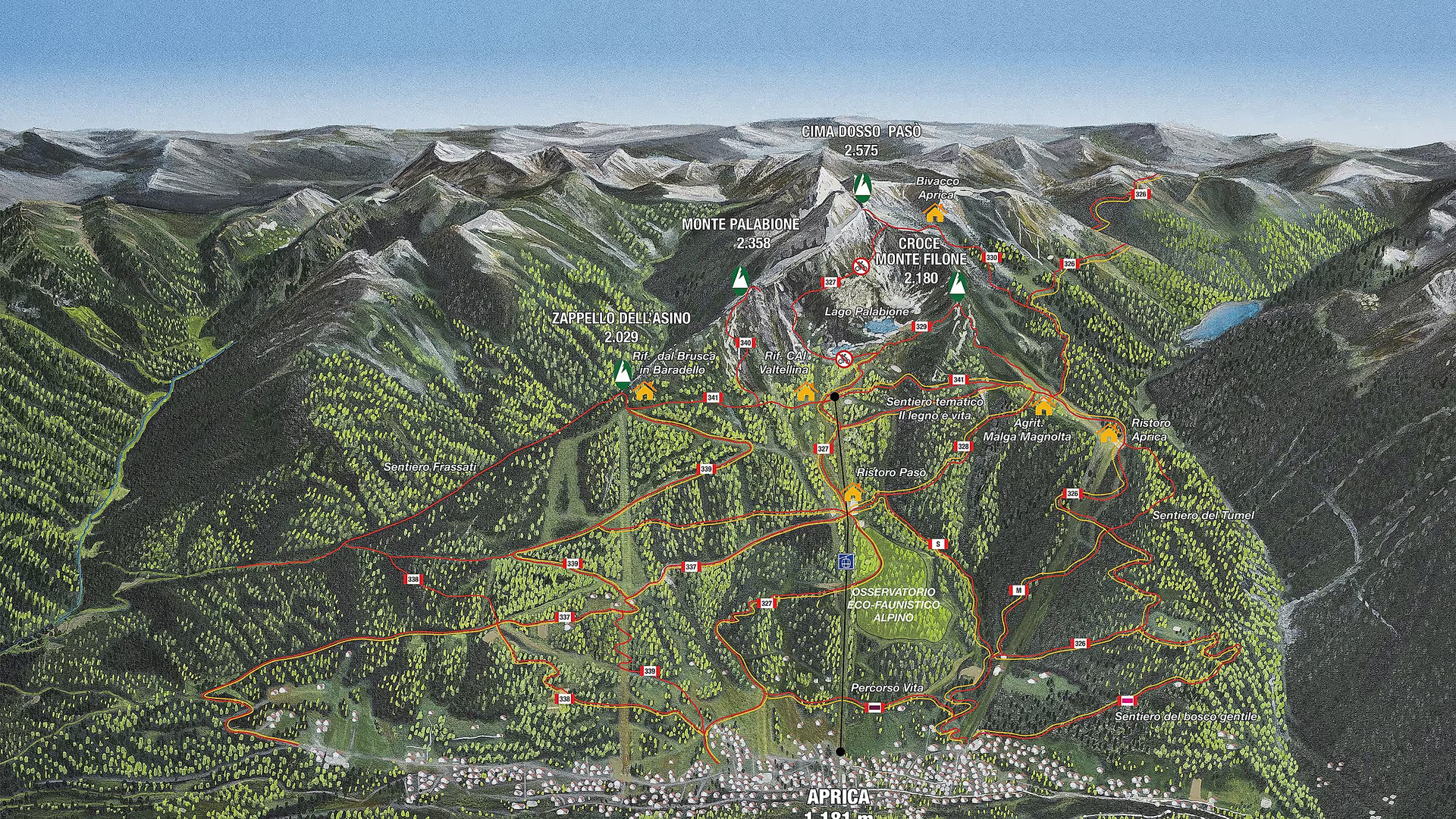
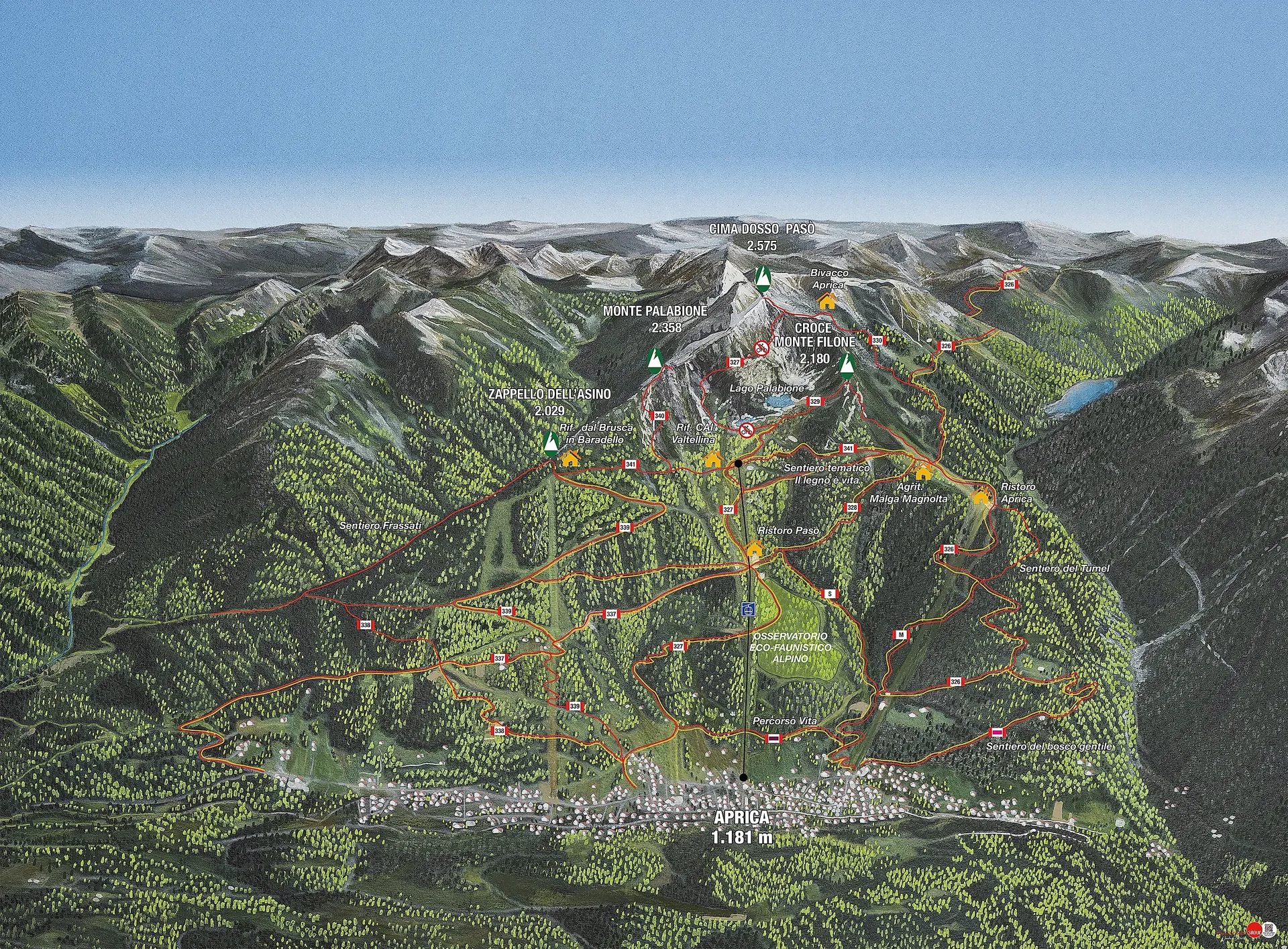
The panoramaboard is one of the most iconic and recognizable elements of sitour Italia: a fundamental tool for offering guests a clear, complete and immediate view of the location. Since day zero we have been creating maps capable of telling the story of the area, guiding visitors and enhancing the identity of mountain destinations.
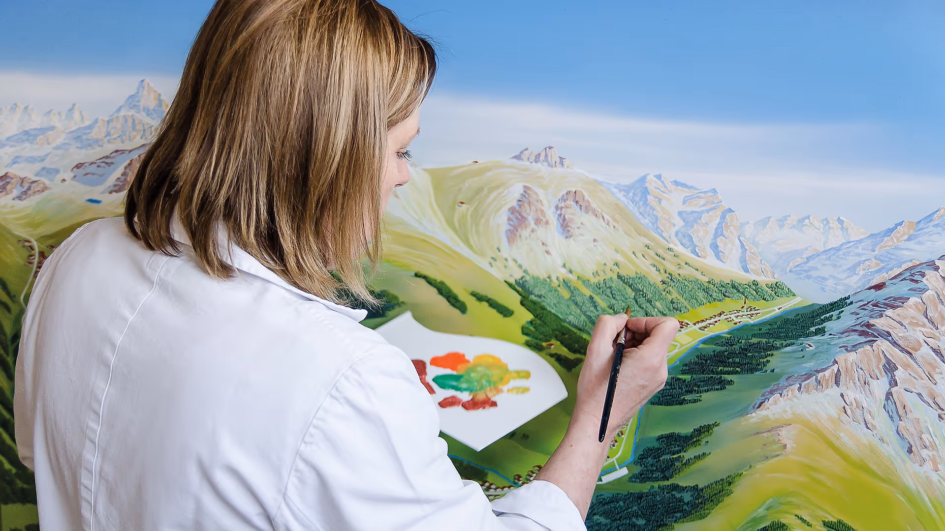
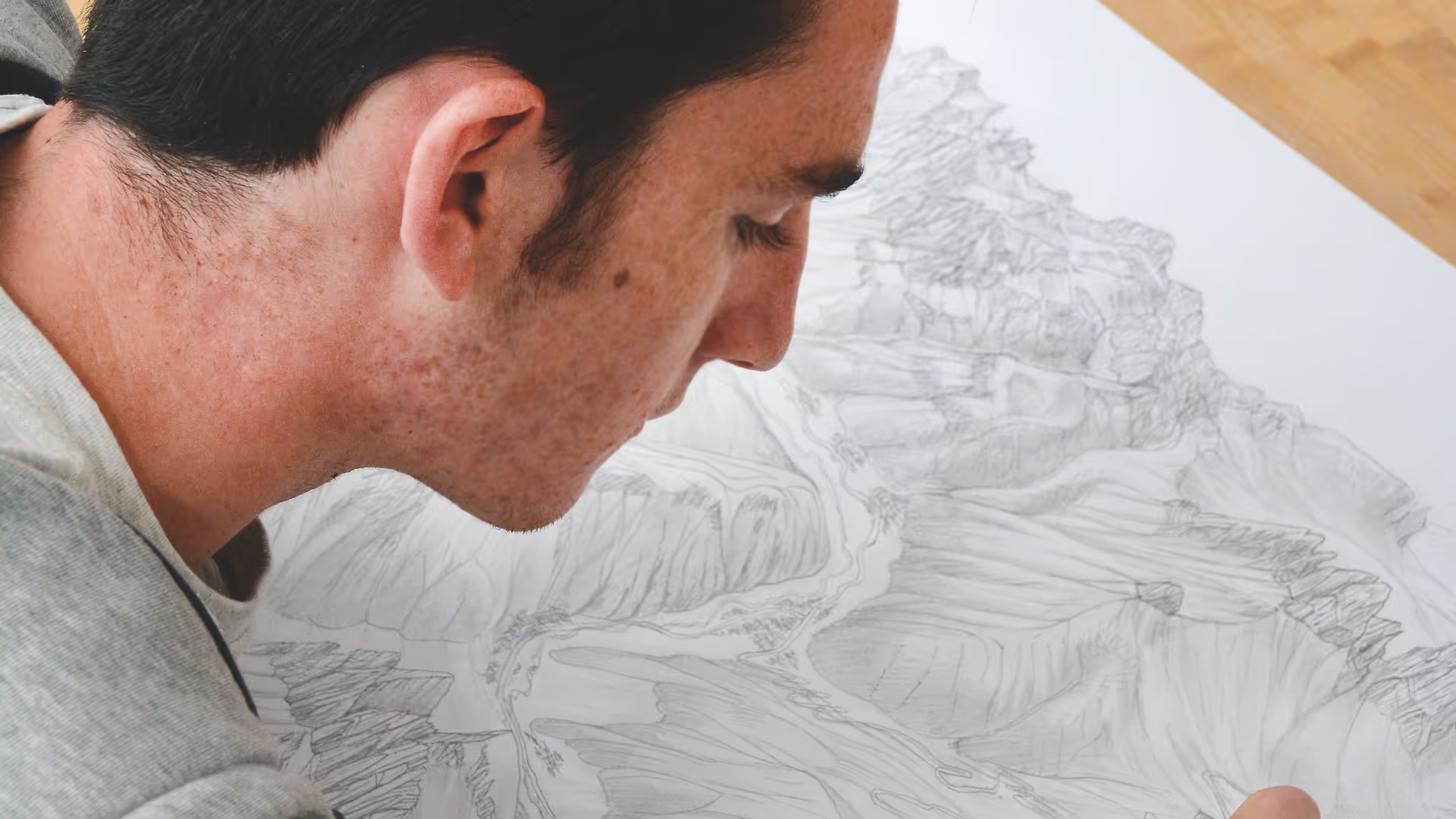
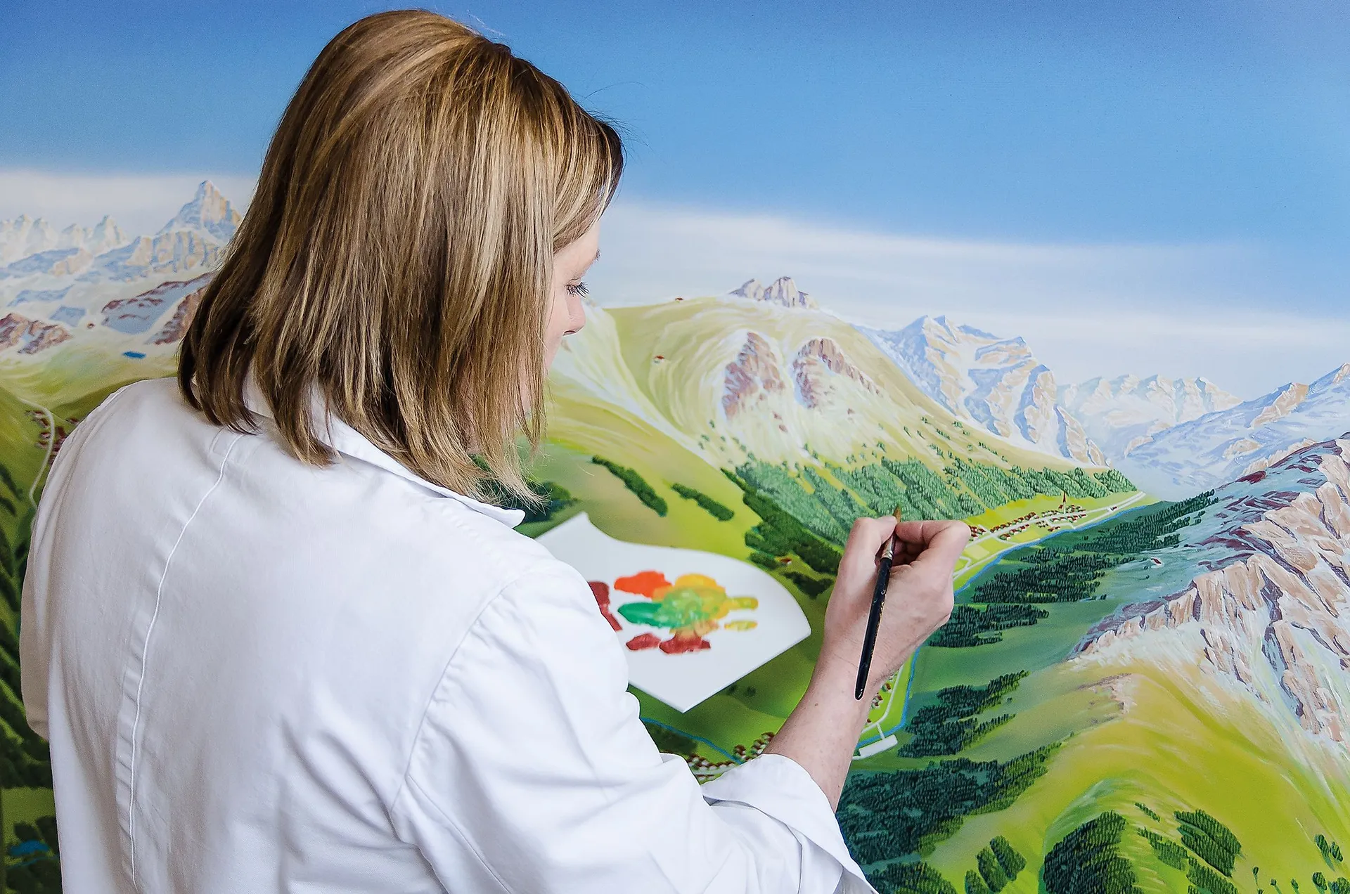
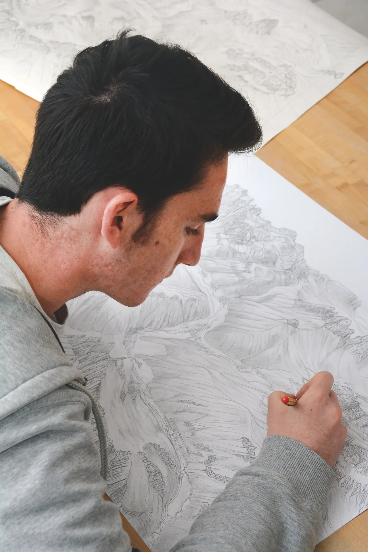
From the earliest hand-painted versions to today's digital productions, the panoramic map has become a timeless classic, now made even more accurate and immersive thanks to state-of-the-art graphic technologies.
The sitour panoramic map began as an artistic representation to orient guests in alpine ski areas. Today it evolves into a modern, digital product that combines tradition, aesthetics and functionality.
Whether it is a panoramic map or a tourist map, the goal is one: to provide an immediate and intuitive glance, capable of connecting the visitor with the territory.
Each Sitour panoramic map is the result of an articulate and meticulous process:
The result is an accurate, harmonious and recognizable representation, capable of accompanying guests throughout their mountain experience.
After digitization, the map can be transformed into an interactive tool:
An evolved support that combines aesthetics, functionality and immediacy, making visual communication more effective and engaging.
The sitour panoramic map continues to be a symbol of Alpine locations: an element that facilitates orientation, enhances the landscape, and improves the visitor experience through a clear, elegant, and always up-to-date visual language.
"In the landscape you find what is there, what you see plus something else that belongs only to your imagination." - Fabrizio Caramagna
sitour Italia combines decades of experience with the constant search for innovative solutions, developing state-of-the-art technologies and media strategies for mountain regions, always geared to market needs.
sitour Italia offers customised and tailor-made communication solutions, ensuring an effective connection with the public in mountainous areas.
sitour Italia is part of the largest network specialising in digital Out-of-Home advertising and information technology for ski areas and mountain destinations in the Alps.